The Met Office has extended a previously issued weather warning for wind until midnight tonight (Friday), expecting gale force winds to continue to cause disruption within the reason.
As Storm Éowyn travels over the region, strong winds are causing disruption including cancelled train services, flights, fallen trees and more.
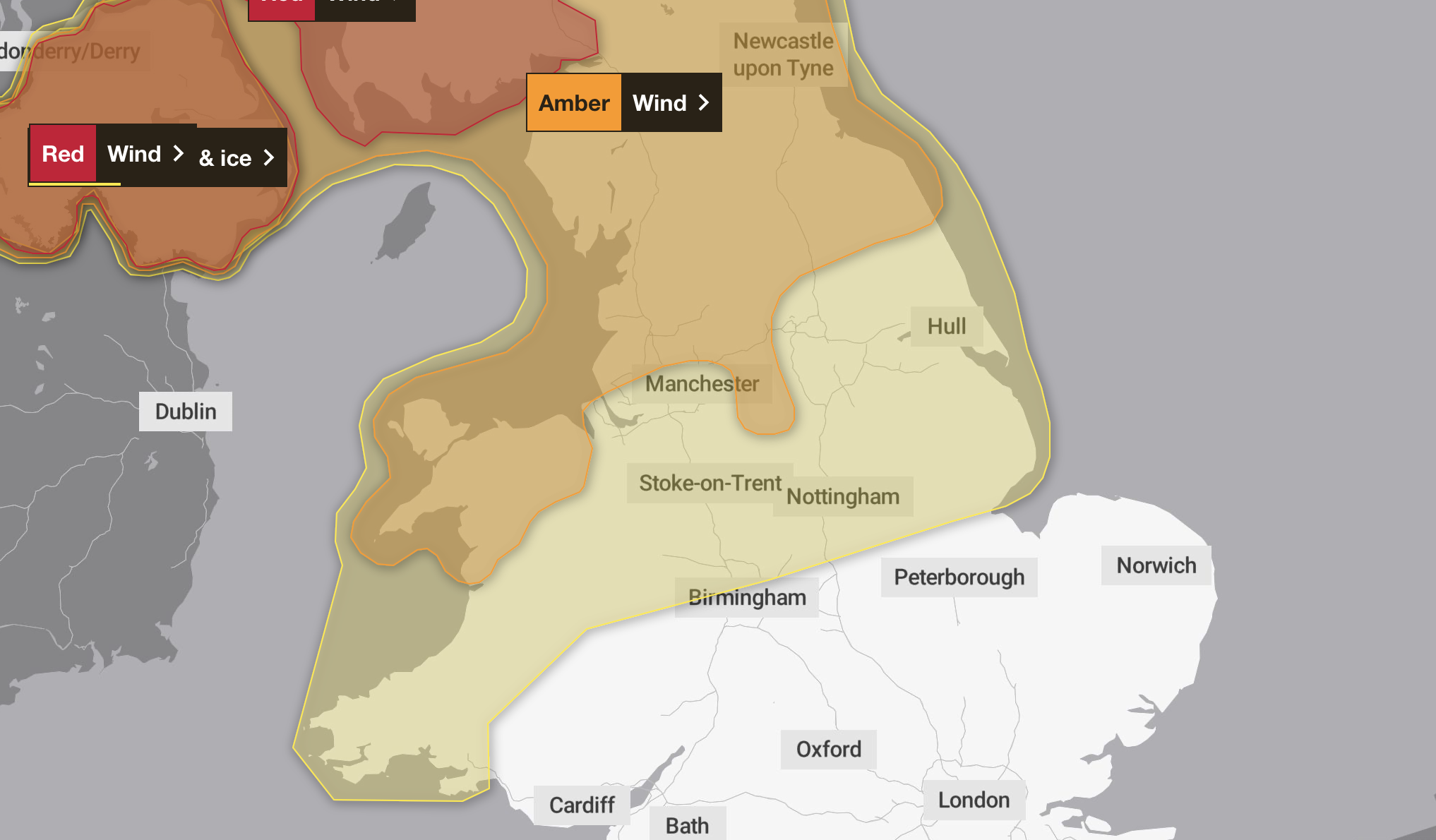
The most serious warning, danger to life, has been issued to parts of Northern Ireland and Scotland, and Amber warnings remain in place in Derbyshire and Yorkshire.
As the storm heads to the north of the country overnight, cold spells are expected to arrive, with temperatures expected to plummet, resulting in a Yellow Weather warning being published for Saturday morning, between 3am and 10am.
Showers will move across this region on Friday evening and early Saturday morning. Skies will clear following the showers with ice likely to form on untreated surfaces and lead to some hazardous travelling conditions.
What Should I Do?
Keep yourself and your family safe when it is icy. Plan to leave the house at least five minutes earlier than normal. Not needing to rush, reduces your risk of accidents, slips, and falls.
If you need to make a journey on foot, try to use pavements along main roads which are likely to be less slippery. Similarly, if cycling, try and stick to main roads which are more likely to have been treated.
Give yourself the best chance of avoiding delays by checking road conditions if driving, or bus and train timetables, amending your travel plans if necessary.
Be prepared for weather warnings to change: when a weather warning is issued, the Met Office recommends staying up to date with the weather forecast in your area.
Additional yellow weather warnings for rain are in place for South Lincolnshire for Sunday and Monday.